Sunday, September 28, 2008

Foggy Phelps and a Misty Mount Jo

Three ADK chairs
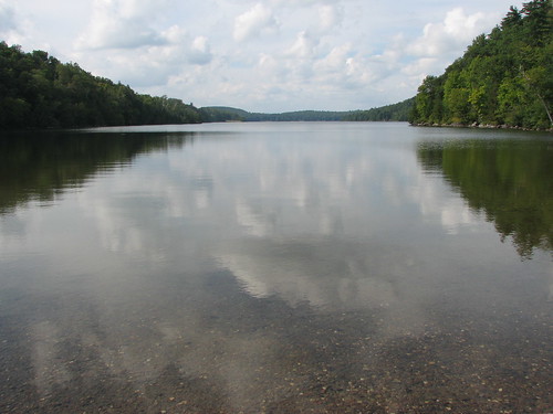
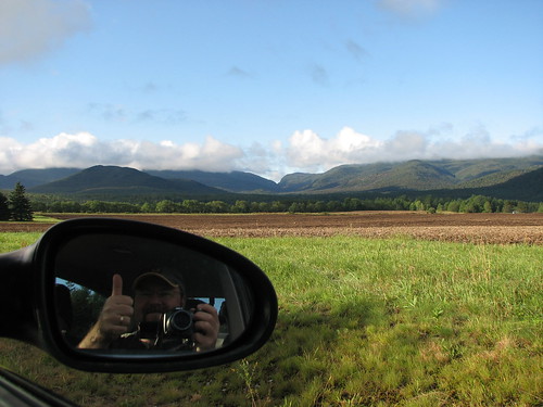
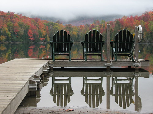
Early morning reflections on Heart Lake
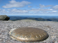
Phelps
Elevation: 4161 ft (1268 m)
Peak: N44 09.420 W73 55.260
Parking lot: N44 10.945 W73 57.769
Distance: 16.2 km

The original plan was tossed. The weather called for 60% rain both Saturday and Sunday and we were no longer going to join Ken in mounting Dix and conquering his 46th peak. Time for plan B. Pack up and go camping at the Loj anyway.

The problem was not everybody bought into Plan B. Rick understandably didn't want to drive all the way down from T.O. to hike in the rain and Mike opted to stay home in his cozy bed. That left just Ken and I willing to throw caution to the wind and go for it. And we're glad we did. The weekend proved to be perfect hiking weather although admittedly the skies didn't clear up completely to allow us the awesome views we've become accustomed to. But it did stay dry.

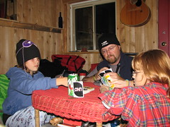
Ken and I drove down via Ogdensburg making excellent time to Lake Placid where we stopped to pick up some snacks and a survival pack of Long Trail. We then checked in, set up camp, and headed back to the Lake Placid Pub and Brewery for supper (I highly recommend the Pulled Pork BBQ Sandwich). Hunger at bay, we headed back to camp for a fire and some pints.
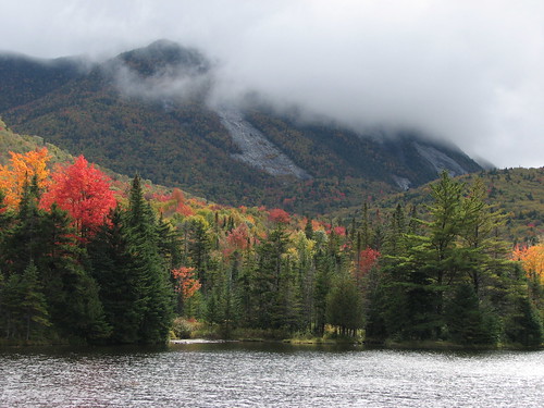
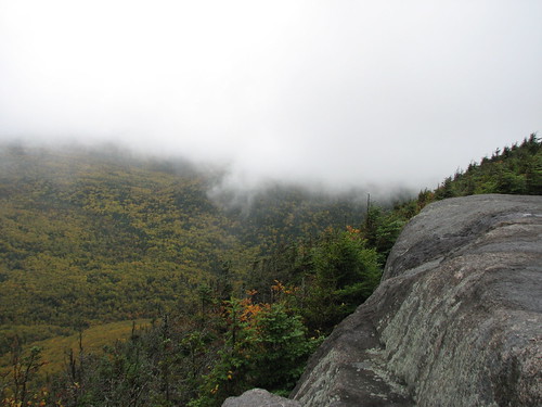
Colden from Marcy Dam
Clouds on Colden

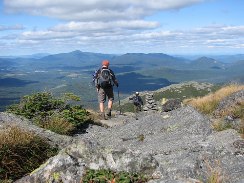
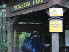
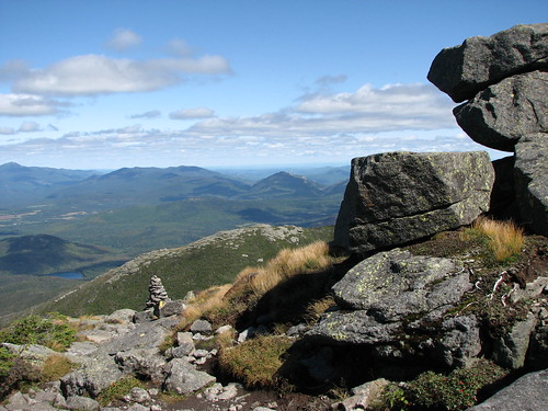
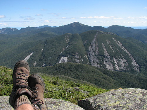
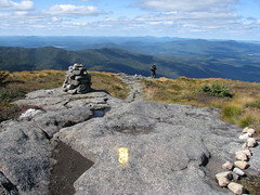
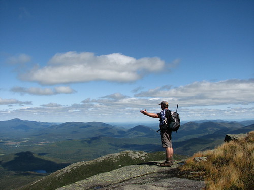
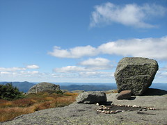
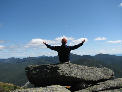
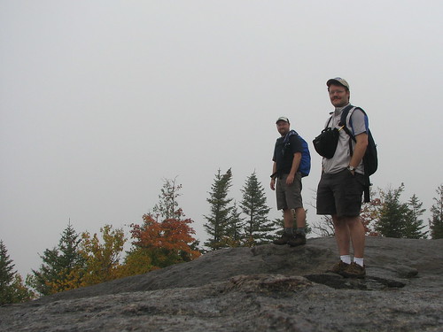
The next morning we woke to find a very gray sky but not a drop of rain. Sweet. A quick bite and a hot cup of joe and we were off to conquer Phelps, peak #32 on the 46er list. We both knew before hand that it was going to be very unlikely that we'd get a great view but hey, what else were we going to do but hike in the ADK? Besides I wanted to knock off another peak.

Sign, sign, everywhere a sign
Splash of colour Signing in at Marcy Dam

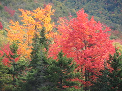
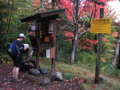
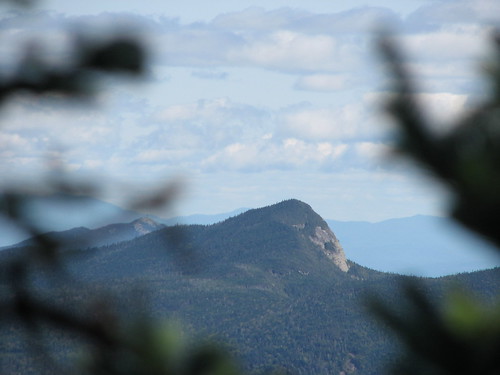
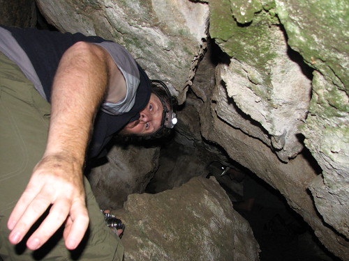
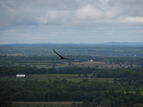
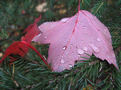
After a fairly flat hike from camp to the Marcy Dam we started our ascent. Some time later we arrived at the top of Phelps to find an empty slab of rock and, as we well expected, the view was less than spectacular. However from time to time the breeze would blow the cloud and fog away and we would be treated to a splash of fall colours. It was actually quite amazing how as the fog would come and go in a matter of seconds giving us a glimpse of the nearby peaks and the yellows and reds in the valley below. Mother Nature's magic show.

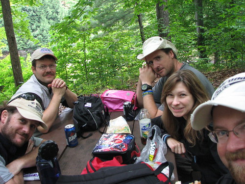
Soon the silence was broken as other hikers came rolling in. In a matter of minutes we were surrounded by about 25-30 people milling about eating lunch and chatting. One group was even cooking up some soup in an Irish kettle. Time to go.

A foggy Phelps
Dew drops on a red leaf Campfire tales

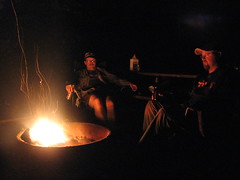
With another peaked bagged we hiked back to camp, showered up and drove into town for some supper. This time we hit the Railway Station Pub and again I was impressed by the food. Then back to the store for a few more snacks and a case of Long Trail Ale and we were ready again to relax around the campfire.
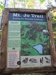

Mt Jo
Elevation: 2887 ft
Peak: N44 11.370 W73 58.010
Distance: 4.5 km

Another morning of rainless gray skies. This time we opted to stroll around Heart Lake with a side jaunt up Mount Jo. Again no view to speak of as we stood on top and imagined what the skyline would look like on a sunny day. At one point a thick mist rolled in and surrounded us with a surreal feeling like we were inside a cloud. In fact, I think technically we were.

Caught in a fog on Mount Jo
Rocks and leaves Mt. Jo Trail map

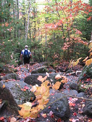
Coming down off Mount Jo, Ken led the way down a side trail that led back to Heart Lake where we veered to the right in order to complete the loop back to camp.

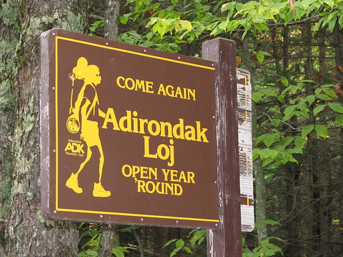
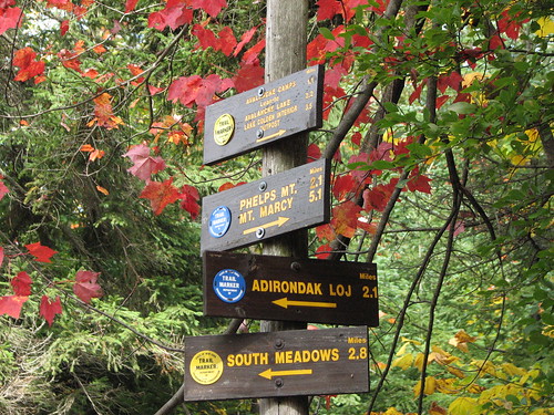
All said and done, we had a great (dry) weekend of camping and hiking. A perfectly executed Plan B. And like the sign says, we'll be back again... soon.

Loj, come again...

Saturday, September 20, 2008

"Mad" Cabin hideout

The Mad Cabin getaway

Friday after work/school the kids and I drove up to our friend's cabin on the Madawaska River to stay the night. For me life's all about "windows of opportunities" and as luck would have it our plan to visit conflicted with our friend's plan to actually be there for the visit.

Apparently my half day advance notice conflicted with their plan to go camping at Bon Echo (with other friends I might add). Not willing to drop what I thought was a great idea I quickly modified it to be an adventure rather than a visit.

Luckily our friends are very accommodating and gave me all the advice I would need to "move in" to the cabin for the night. Advice number one, don't mess with the homemade mouse trap (a bucket of anti-freeze in the corner) and number two, be sure to "check out" the new thunder box out back.

After some convincing both kids decided to join me giving mom some alone time to catch up on some school work. We arrived just after sundown and quickly carried our gear down the steep hill to the river. Somehow we managed to get everything down in only two trips (where's my mule?) but as Sara kindly pointed out you'd think we were planning to stay the week. Ha, such is always the case.

This cabin has evolved into something just the other side of awesome. A great multi-level deck, BBQ and stove, lots of natural sunlight, a cozy loft for sleeping, and now a woodstove for those chilly nights. All you would need and a little more.

Late night UNO A little DS before bedtime
A game of UNO and some late night NDS...

Saturday morning we woke early to the sound of rain... well what we thought was rain was actually the sound of the cascading creek that crosses the path just metres away from the cabin. Sunshine greeted us as we all took turns at "the box" and then I boiled up some water for coffee and hot coco. Today's agenda? Relaxation.

Quiet morning
Caught in a ring Morning paddle
"Pull me in"

In the end we left the mousetrap well enough alone and as requested, we put the new open air outhouse to the test. (No thanks necessary guys.)

Long Trail Blackbeary Wheat
Shout out to the Neills... wish you were here.

Saturday, September 13, 2008

Spelunking in Lusk Cave

Mike comes crawling out

After last weekend's success at spelunking in Gatineau park we decided to finally go for the big one. Lusk Cave at the east end of Lac Philippe. We arrived at the parking lot around 10:30 am where I packed up my swimsuit, sandals, toque and headlight before starting on the 5 km trek to Lusk Cave.

You are here

The hike runs through the campground and past three beaches before continuing along the southern shoreline of Lac Philippe. At the east end of the lake there is yet another small beach with an awesome view of the entire length of the lake. Not surprisingly this is a popular resting spot for bikers, hikers, kayakers, and canoeists.

Lac Phillipe (Gatineau Park)

Turning away from the lake we hiked the last km to the cave where we were chatted up by one of the park's volunteer hikers whose job it is to patrol the trails with his yellow jacket and walkie-talkie. After checking out the cave map and getting some helpful hints we geared up and headed over to the cave's entrance.

IMG_7916
IMG_7924

Once in the cave we found ourselves following a tiny stream that echoed off the walls making it sound like something closer to the size of Niagara. The start of the cave is fairly open with a couple of holes in the ceiling where the sunlight beams down. At one point the ceiling and height of the water approach each other leaving only about a foot and a half of clearance. This meant that we had to crouch way over and shimmy our way through the water to the next opening. Luckily the water was only about a foot deep here but we still ended up getting pretty wet.

Soon we reached the halfway point where the cave opened back up to blue sky. The next half starts with a 2 metre "waterfall" and then winds left and right with a couple of large ledges that you can hop up on to have a rest and get out of the stream. Near the end the clearance again shrinks down to about a foot above the water line but luckily there is a little side route that you can take that makes the spelunking a little easier (especially when you're carrying a camera).

Mike gets ready to dive off the 2 m falls
"There's no way you can fit through there buddy." Mike spelunking

All and all we had a great day and given the original forecast for rain today's warm sunny skies was a definite bonus. This is one adventure that I'll definitely put on my annual hit list, in fact I'm already planning to bring the kids up here to test out whether or not they're claustrophobic.

Spelunking Tripper style
Celebrating our first real spelunking adventure.

Click here for a detailed map of Lusk Cave.

Wednesday, September 10, 2008

Algonquin, she's a beauty eh!

Hiking down Algonquin

Algonquin
Elevation: 5114 ft (1559 m)
Peak: N44 08.616 W73 59.214
Parking lot: N44 10.945 W73 57.769
Distance: 15.3 km

With the weekend forecast calling for rain I decided at the last minute to take the day off to enjoy some sunny midweek weather and join my buddy Mike on another hike in the Adirondacks. It was a damn good call.

After some debate on how cold and icy it was going to be above 4000' we finally decided to throw caution to the wind and just go for it - Noonmark out and Algonquin Peak in.

At 5114', Algonquin ranks as the second highest of the 46er peaks, second only to Mount Marcy. I was stoked. Mike has been telling anyone that would listen that this was his favourite 46er peak so far and I couldn't wait to get on the trail and see for myself.

Our first sight of our day's goal, Algonquin
First light Signing in

We were on the road by 5am and signing in the logbook by 8:45am. We made relatively good time hiking up the rocky trail stopping only briefly at the falls for a snack and a chat with some of the passing dog walking hikers.

After the falls we soon came to the cut off for Wright, another 46er peak. There was no decision to be made, we were Algonquin bound. After a couple of scrambles up some slabs we began to break through the treeline where the "wow factor" kicked in and the cameras came out. Needless to say our speed was greatly reduced at this point.

Big Slide thru the trees
Big Slide pops into view
Rock pass Wallface
Wright from Algonquin
Wright

Once we cleared the treeline entirely I just couldn't seem to stop pumping the button on my camera. There was so much to take in. The other peaks, Lake Placid, Vermont in the distance, the shadows, the clouds, the cairns, and the colours. The lichen had started to turn orange and yellow and all I wanted to do was roll in it but alas the signs and markers clearly indicated that this was frowned upon.

Some time later we finally reached the top and the 360 degree view was something that just can't be captured on film. We stopped to enjoy a quick lunch and then once again picked up the camera to wander around (stepping only on the rock of course) and explore the large summit. At some point we both agreed to pass on nearby Iroquois and Wright peaks in order to allow ourselves more time to soak it all in. Sweet.

Colden
Relaxing view of Colden
Lichen on the hillside Trail down Algonquin
Soaking in the view
Algonquin survey marker, 5114 ft IMG_7765

This was by far the most rewarding hike I've ever been on. The weather was perfect (I like it a little cool so I don't sweat my gonads off) and the views were absolutely breathtaking. I'm still on a high and find myself changing my computer's wallpaper every hour or so.

On top of Algonquin

Algonquin is definitely going on my repeat list... well, technically it's already on there if I ever want to be a 46er as it lies between me and Iroquois.

Sunday, September 07, 2008

Gatineau spelunking

Bat in the cave

Today I joined up with Mike, Ken, Dave, and Diane to do some hiking and a little caving or spelunking in Gatineau Park. Apparently there are two terms floating about that are used to describe a person that explores caves - one for for the experts (cavers) and another for the rookies and wannabees (spelunkers). We are obviously the latter.

grizz in the cave

As expected, the "cave" was more of a small hole in the ground that would allow 3-4 people in the entrance and then, if willing to get very muddy, one could crawl down around and then up and out the back door. Oh and said person would have to be pretty tiny too.

Regardless we all loved it. After some time exploring the cave and snapping photos we continued on down the trail.

Swooping around
Old Mountain Dew can

The Old Mountain Dew can I found was an interesting piece of history. The catch phrase on it read, "It'll tickle yore innards!" and it had a cartoon of a hunter chasing a rabbit with a rifle. The top was actually an old style top that required a can opener to punch holes in it. I wish now that I had kept it but alas all I have is this photo.

As we approached the parking lot we decided to stop at a picnic table and have some lunch and a pint. Good times.

Lunch time

(Note who has the Power Rangers lunchbox and who has the bright pink one. Too funny.)