Sunday, August 31, 2008

Jeffrey and Sherri... and an awesome Italian meal

Peace dove

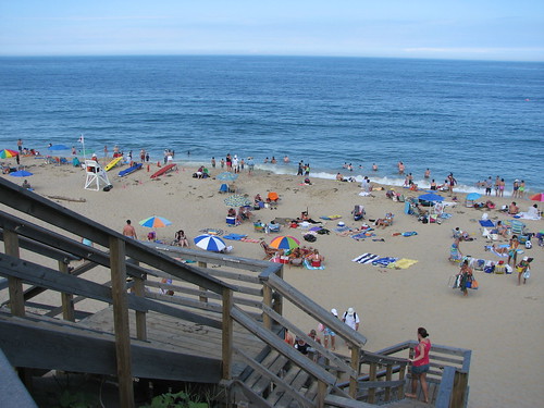
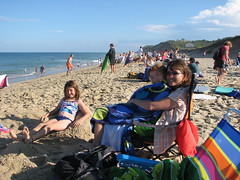
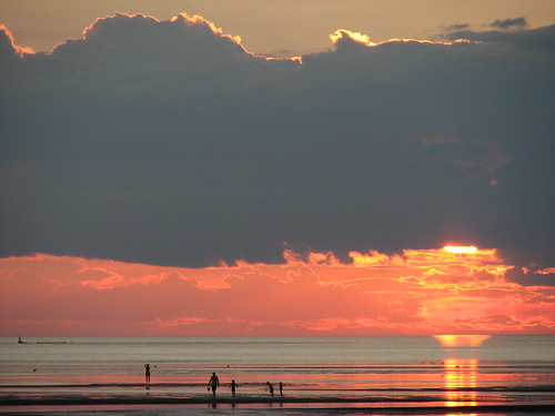
Once a year we all manage to meet for a few days up in the Sault. Normally we head to Pancake Bay on Lake Superior and bake on the beach but this year it was the wedding of Jeffrey and Sherri that had us all gathered together. Well... Jeffrey, Sherri, and a hearty Italian meal.
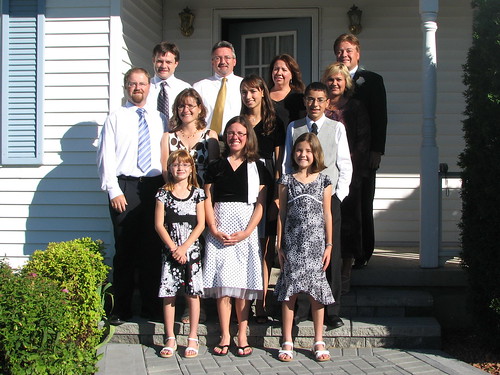
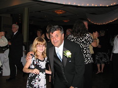
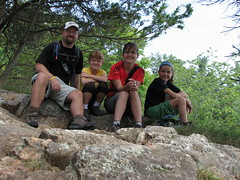
The whole gang
The gang

Cousins
Cousins

The wedding was at 1 pm and was all wrapped up by 1:30 (is it only Catholic weddings that are an hour or more?). There were seven on each side including the best man and maid of honor. Guests totaled over 350. There was no mistaking this for anything but an Italian wedding. After the ceremony we headed over to cousin Diane's for some food and refreshments. It was a great chance to chat with a few of the out of town guests but at the same time it was difficult to hold back on all the delicious snacks as we all knew we'd have to save our appetites for the evening.

The menu

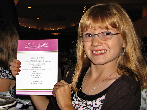
Finally the moment we'd all been waiting for...the food had arrived. Antipasto Italiano, chicken noodle soup, fettucine, meat ravioli, meatballs, chicken cutlets with mushroom sauce, roast potatoes, green beans, tossed salad, and of course wedding cake with coffee and tea.

I have been to many many weddings over the years (one summer we attended 8) and most serve a good meal but not one of them compare to an Italian wedding in the Sault. Words can't describe.

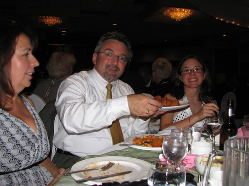
When the Italian meatballs and ravioli were served we all pulled out our cameras to record the glorious moment.

Jay takes a third helping of meatballs

After the meal and speeches - congrats again to Uncle Peter who was MC'ing the event - the 11 pm dessert tables were set up for those that might have a small hole left to fill. All homemade decadent Italian pastries - biscotti, genetti, pizzelle, tart, cakes, and plenty of fresh fruit. Needless to say I forced myself to indulge.

Jeffrey and Sherri's wedding

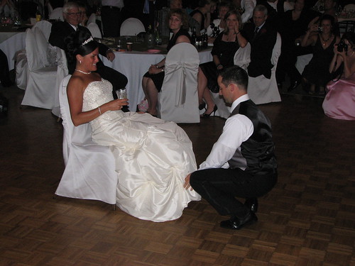
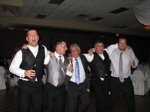
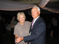
The rest of the evening was fairly standard - garter belt toss, bouquet toss, first dances, and lots of laughs and good times. Thank you Jeffrey and Sherri for bringing us all together on your big day.

Did I mention it was an open bar?
Jeffrey and Sherri's wedding
Emma and Abbie Jeffrey and Sherri's wedding

Friday, August 29, 2008

King of King Mountain

King Mountain Trail

King Mountain
Elevation: 1850 ft (564 m)
East Peak: N46 47.369 W84 19.180
West Peak: N46 47.372 W84 19.608
Parking lot: N46 47.165 W84 21.172
Distance hiked: 20.3 km

Today I declared myself king of King Mountain.

I arrived yesterday afternoon from Ottawa for a family wedding and decided to take advantage of the great weather and some free time. I parked the van at the Stokely Creek Lodge to find an empty bus and dozens of abandoned camping chairs. I assumed they were some Boy Scouts in the area but I was soon proved wrong when I was greeted by 65 college girls (and boys) jogging on the ski trails.

IMG_7308

It turns out they were with the Calvin College Cross Country Running clubs in Michigan and were here doing some hard core training in Canada's Great White North. A short chat with the new owner (Gaylen) of the lodge informed me that they had already hiked to the top of the west peak of King Mountain and that they wouldn't be heading up there again this weekend. Perfect. He then gave me a couple of trail maps and an update on some of the repair work they've been undertaking (including the missing bridge which proved to be good intell).

Stokely Creek Lodge sign and trail map

After a few more "good mornings" to the sweaty college girls I was finally on my way.

At some point in the hike I decided I would summit both King Mountain East and King Mountain West to compare both views and get in some training before my next big hike in the Adirondacks. I ended up doing a 20 km loop that brought me first to Mantle Trail and the east lookout and then to King Mountain Trail and the west lookout.

Sunshine breaking through

After the huge rainfall the night before the overgrowth on Mantle Trail was sopping wet and I was soon drenched and sloshing in my boots. No matter, I expected as much and it certainly wasn't going to stop me from getting to the top.

East King Mountain view

The east summit had a small but nice view but what was more interesting was finding the remains of an old fire tower. Too bad it wasn't still standing as a 360 view from here would have been spectacular.

West King Mountain view

The west lookout from King Mountain is where all the action is - there was a nice viewing platform with a couple of benches, a plaque dedicated to Stephen Taylor for his work on the Voyageur Trail, and a small hut with a woodstove for those cold cross-country skiers in the winter. I stayed here long enough to snap some photos, dry my socks, and have a small lunch of Pino's Italian sausage and a Blue. A great celebration to the end of summer.

King of the hill

Tuesday, August 26, 2008

Charleston Lake getaway

Checking out Mud Bay

This was our last camping trip for the summer holidays. Short but sweet. Weather was great and we even had a surprise guest stay with us on the first night.

Amber is her name and she is damn cute. She's an 8 week old cross between a Golden Retriever and a Golden Lab. This little creature is a chick magnet... ok ok, truth be told it was a people magnet as nobody seemed to be able to resist stopping for a chat and chance to pet the puppy.

Amazingly she slept right through the night without one single peep. Not surprising since the girls ran her ragged all afternoon and wore her out.

Amber

Needless to say we were all very sad to see her leave the next day but somebody (need I say who?) had to get back and cut the grass.

Since the trip was only a short 3 nights we decided to leave the canoe at home and do some hiking for a change. Sunday we hiked the short Quiddity Trail to the lookout and Saturday we hiked part of the 10km Tallow Bay Trail.

Here are some of the sites and creatures spotted along the trail.

The camouflaged butterfly.
Butterfly camouflaged Butterfly un-camouflaged
Green tree frog
Green frog
Group shot on top of Quiddity Trail lookout Bullfrog

I often see these unique white berries along the trails. This time I decided to look them up on the Internet and see what they were all about. White Baneberry or "Doll's Eyes" is the name of them and apparently they are extremely poisonous - 5 or 6 will make you seriously ill, more could cause cardiac arrest and death. SGD, that's good to know.

Doll's Eyes
White Baneberry aka Doll's Eyes

We spent a fair bit of time searching our usual hiding spots for snakes. To the dismay of some (but not necessarily all) we came up empty handed.

Crossing the boardwalk at Slim Bay.
Crossing Slim Bay
Spider eats dragonfly Dragonfly rescue

Sunset on the beach... actually we missed sunset but the afterglow was still worth a photo or two.

Charleston Lake sunset

On the last day when we were heading out of the park when we (again) bumped into our old friends the Tardioli's and their three boys. We quickly changed our plans and headed back down to the beach for a couple more hours so we could chat and watch the kids knock each other in the head with pool noodles. Good times.

Also of note, we bumped into my friend and fellow curler Lessie (aka Mike). He was soaking up some rays with his 28 friends and family. Quite the gathering.

Wednesday, August 20, 2008

Gothics via Pyramid

Enjoying the view from Pyramid

Pyramid Peak
Elevation: 4515 ft (1376 m)
Peak: N44 07.416 W73 51.372

Gothics
Elevation: 4736 ft (1444 m)
Peak: N44 07.668 W73 51.442
Parking lot: N44 08.982 W73 46.057
Distance: 22.2 km

Today I decided to take the day off and join Mike on another hike in the Adirondacks. This time his plan was to tackle Pyramid via the Arthur Weld Trail. From there we would move on to Gothics and complete the loop back down Beaver Meadow Falls trail to the car.

The start (and end) of the trail follows the road for about 5-6 kms through the Ausable Valley Golf Club home to some fine green with some stunning back drops.

View from the Ausable golf course

Once past the golf course we signed the log book and started down the road to Lower Ausable Lake where we would start our climb.

Almost immediately after crossing the bridge over the dam we hit a sign marking a side trail to Rainbow Falls. On a whim, we decided to head down it and see what it was all about. Wow. No regrets, this was a spectacular falls. Apparently it is nearly 150 feet - the highest in the Adirondacks. And lucky for us there was a fair bit of water cascading over the top thanks to all the recent rain.

Rainbow Falls
Rainbow Falls

Once past the falls we started the gradual, and then not-so-gradual, climb up to Pyramid Peak. Coming out of the bush and stepping onto Pyramid is breathtaking. The peak is only a tiny piece of exposed rock that could maybe allow 6 hikers to comfortably sit and enjoy a break. But the view is anything but "tiny". It's grand. From this vantage point one can easily spot several of the 46 peaks including Gothics which was next on our day's hiking list. Left to right Mike (not I) could name off Dix, Nippletop, Colvin, Blake, Sawteeth, Haystack, Marcy, Basin, Saddleback, and Gothics.

View from Pyramid (pano)

After about an hour of relaxing, eating, snapping photos, chatting with some fellow hikers, and generally soaking it all in we moved on to Gothics.

The slide off Gothics

Looking back at Pyramid Peak
Looking back towards Pyramid

While quite nice on its own, Gothics' view just didn't have the same awe-factor as Pyramid. However Gothics does count as one of the infamous 46 peaks, unlike Pyramid which does not (due to a technicality it's considered to be a sub-peak of Gothics).

Gothics
Gothics survey marker

Gothic Ravens
Ravens riding the wind off Gothics

On the way out we passed another waterfalls, Beaver Meadow Falls. We stopped long enough to wash some of the sweat and salt off and snap a few more pics before heading down the trail in hopes of hitting the road before dark.

Beaver Meadow Falls
Beaver Meadow Falls

All said and done it was a 20.5 hour day from the morning alarm until finally arriving back home. Hiking time was about 11 hours. Total number of photos taken between the two of us was around 600 plus a 14 minute video clip. Making memories.

Saturday, August 16, 2008

Jack Pine stroll

Jack Pine boardwalk

We took advantage of a rare spot of sunshine and headed out for a stroll through the Ottawa Greenbelt. Starting out from Jack Pine we walked around for about an hour and a half looking for snakes but came up empty handed. We did find lots of other life in the swamp lands though.

Dragonfly stare down
Froggie
IMG_6208

Friday, August 08, 2008

Cape Cod, MA

Beached boat

Our first trip to Cape Cod was all the way to Provincetown on the tip. Traffic was light all the way allowing us to make it in about 2 hours from base camp. After a minor squabble with the parking attendant I managed to calm him down enough to get some advice on beaches and hiking trails. Apparently the Provincetown beaches are very close to the harbor where boaters tend to dump their waste (aka stinky poo-poo) which is the reason why this 24 year resident warned us that swimming from the local beach is not something he recommends. Instead he suggested one of the many beaches along the National Seashore (pdf map here) where we could also hike one of the many trails. He also warned me that this year was seeing a high level of inappropriate trailside behavior. "Just use the blinders.", he said as he demonstrated using his hand at the edge of his eyes. I think he winked at me too but I can't be certain.

Race Point Beach was our first Cape Cod beach. It was beautiful. It was a hot sunny day and the Atlantic was definitely refreshing. We relaxed here for a few hours before heading down the shoreline to check out another National Seashore beach. Once purchased, the day pass for this area allows you to park and visit any of the beaches in the Cape Cod National Seashore park. If you're Dutch, you will hear the word "free" in there somewhere.

Race Point Beach, Cape Cod
Kid crashing wave Mermaid's purse

Our next stop was Nauset Beach. We arrived at about 2:30pm and the lot was full but the wait for an opening was not long. This beach was definitely the most memorable beach for us. The waves were much bigger than at Race Point and the water was slightly warmer too. We spent another 2-3 hours here relaxing and taking photos of each other wiping out in the crashing waves. As the day wore on the waves started getting bigger and they were curling out further from shore. This meant that fewer people were being swept off their feet and more surfers were pulling out their boards. Another entertainment scene was about to unfold.

Nauset Beach, Cape Cod
Nauset Beach, Cape Cod Wipe-out Swallowed by a wave

Finally we left the beach and started to make our trek back to base camp. At one point I decided to turn off and explore one of the Cape side beaches. First Encounter Beach ended up being the random pick. We arrived about an hour before one of the most spectacular sunsets I've every seen. The colours popping out of the sky and water were amazing. Impossible to catch on camera but I tried.

First Encounter Beach sunset
Sunset over Cape Cod First Encounter Beach sunset

The last day on the Cape we drove down to Woods Hole and Hyannis Port, summer getaway for the Kennedys. We also managed to squeeze in a tour of the Cape Cod Potato Chip factory where we scored some free samples and of course one last trip to a beach. This time we hit Town Neck Beach in Sandwich where we could watch the boats, large and small, come and go through the canal.

Cape Cod Potato Chips Cruise ship leaving Cape canal
Town Neck Beach, Cape Cod Smelly dead crab

Oh, and we did see another lighthouse or two along the way.

Nobska Lighthouse

Another great day spent making memories. All said and done, we still have several things left on our Cape Cod to-do list... oh well, there's always next year.